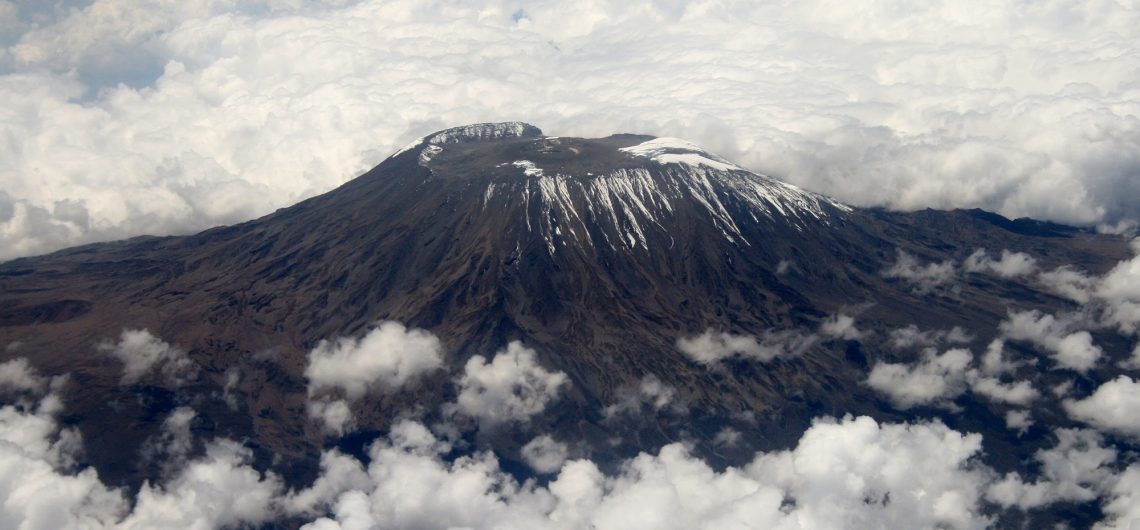
How was Mount Kilimanjaro, a mountain that has distinct geology and history formed?. Our planet's surface is divided into several separate portions, some large and others little. Tectonic plates are what they're called. Africa is one of the biggest continental plates on the planet. The plates do not remain stationary; instead, they move around the earth's surface, propelled by convection currents in the mantle. Some sink or subduct beneath others, others clash, and still, others split up. This is exactly what is going on in Africa. In East Africa, the East African Rift Valley is a growing divergent plate boundary. The Somalian plate, which makes up the eastern half of Africa, is sliding away from the remainder of the continent, which is made up of the Nubian plate. A rift valley has resulted from this expansion. The crustal expansion has resulted in a succession of lengthy lowland valleys divided by highland areas. Read more facts about Mount Kilimanjaro. Volcanoes develop when plates split apart, according to one of plate tectonics' basic laws. This is why Kilimanjaro, as well as other well-known volcanoes like Ol Doinyo Lengai, exist. Mount Kilimanjaro was produced as part of the Great Rift Valley's creation. Volcanic activity focused on a few distinct places almost a million years ago. Kilimanjaro is really three volcanoes stacked on top of one another, rather than a single mountain summit. Shira, Mawenzi, and Kibo were formed roughly 3 million years ago with the formation of the Great Rift Valley. Due to enormous forces that drove the crust skywards, Shira was the first to develop. Shira collapsed to form a caldera around 500,000 years ago, while Mawenzi began to develop about 460,000 years ago. Kibo was produced by another eruption west of Mawenzi. Shira, the lowest peak at 12,995 feet, last erupted
How was Mount Kilimanjaro, a mountain that has distinct geology and history formed?. Our planet’s surface is divided into several separate portions, some large and others little. Tectonic plates are what they’re called. Africa is one of the biggest continental plates on the planet. The plates do not remain stationary; instead, they move around the
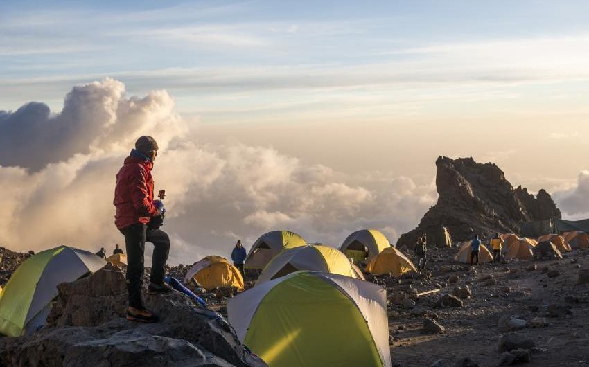
The Lemosho route is more popularly considered as the best one of all the routes because it provides many acclimatization opportunities on route to Shira 2 Camp. Guests can adjust more at Shira Needle, Shira Cone, Shira Cathedral, Lava Tower, and other points along the journey. All while trekking on one of the world's highest Plateaus. The Shira Plateau is the highest point of the Shira Mountains. Hike high, sleep low is a mountain concept that works its magic on your body. When you're at a lower height, your body has a standard number of red blood cells that 'carry' oxygen throughout your body; but, when you're at a higher elevation and there's less oxygen, your body needs more red blood cells to 'transport' the oxygen around your body. Hiking higher and sleeping lower gives your body a shock, causing it to create more red blood cells and therefore acclimate. Below are the reasons why the Lemosho route is the overall best route to climb Mount Kilimanjaro. Read more about the Lemosho Route Better Acclimatization The key to success on Kilimanjaro is to spend as much time as possible on the mountain. According to our data, climbs based on seven days have an 85 percent success rate, whereas climbs based on eight and nine days have a success rate of over 95 percent. Altitude sickness is less likely as a result of this. The longer you stay on the mountain, the less likely you are to succumb to altitude sickness. On the Lemosho Glades, there are several opportunities to stay an extra night to further acclimate... It's less busy and less crowded. The Lemosho Glades path is likely the least popular route on Kilimanjaro when you begin climbing Mount Kilimanjaro, partially due to its remote position and similarly the challenging
The Lemosho route is more popularly considered as the best one of all the routes because it provides many acclimatization opportunities on route to Shira 2 Camp. Guests can adjust more at Shira Needle, Shira Cone, Shira Cathedral, Lava Tower, and other points along the journey. All while trekking on one of the world’s highest
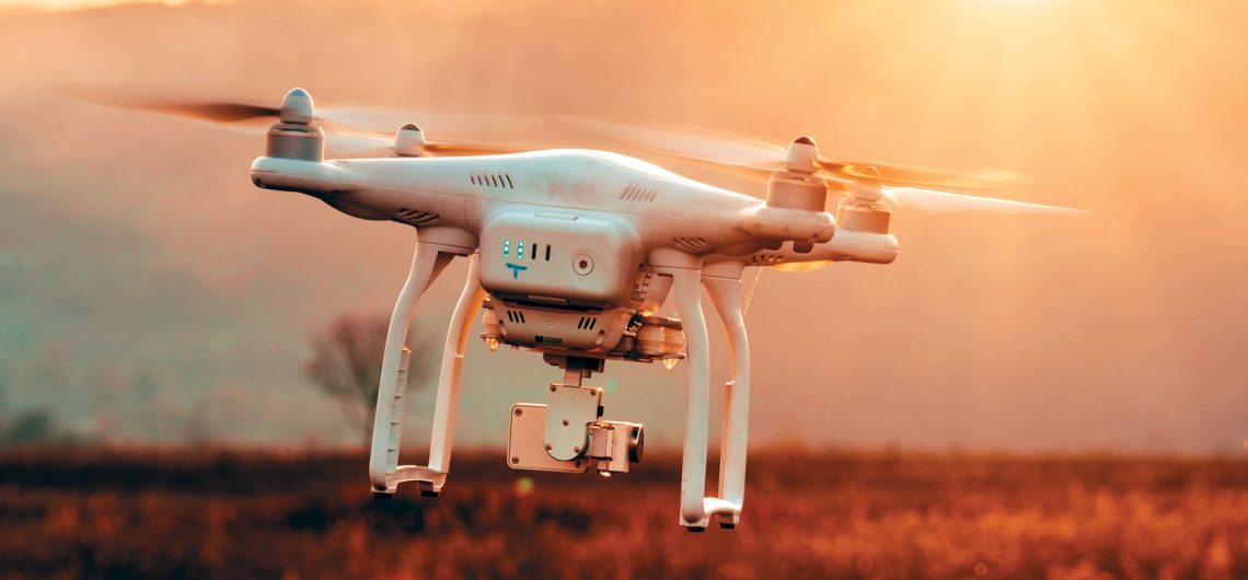
The Tanzanian regulatory authorities and animal conservation agencies have made it clear that using aerial drones in Tanzania's national parks, such as Kilimanjaro, is prohibited. I strongly advise you not to fly a drone there unless you first obtain written permission from the relevant regulatory body or bodies. I recommend that you contact the Tanzanian embassy or consulate in your country for more information. To legally operate a drone in Tanzania, you must first register it, obtain a pilot's license, obtain necessary drone insurance, obtain a specific licence from the Tanzania Civil Aviation Authority, and obtain approval from the Ministry of Defense and National Service. To put it another way, legally flying a drone in a national park is a long and arduous procedure. Tranquil Kilimanjaro is unable to assist you with this procedure. Even if you get a permit to fly a drone in Tanzania That is to say, it is physically demanding/nearly impossible but lets say you can, these will be your main challenges. Mount Kilimanjaro is the world's tallest peak that can be climbed without ropes. That does not imply that it is simple. It's so cold up there that you'd need at least two-three layers of gloves on, making it impossible to use the controller. A drone would have to work considerably more just to keep balanced because it's so high up and windy. Because of the thinner air, the A drone would have to work considerably more just to keep balanced because it's so high up and windy. The drone is less stable due to the thinner air. Some people are unable to reach the summit due to the extreme altitude. Those that can even make there in the first place (unless they're a pro) struggle. To operate a drone at the highest level would
The Tanzanian regulatory authorities and animal conservation agencies have made it clear that using aerial drones in Tanzania’s national parks, such as Kilimanjaro, is prohibited. I strongly advise you not to fly a drone there unless you first obtain written permission from the relevant regulatory body or bodies. I recommend that you contact the Tanzanian
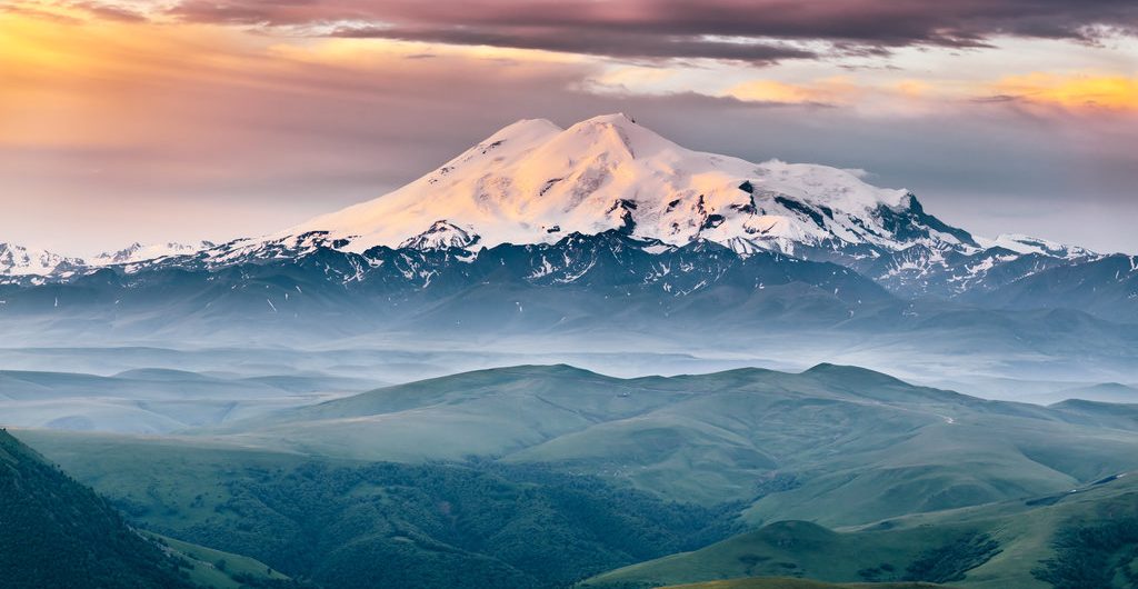
The difference in height between Kilimanjaro and Elbrus is about 253m. Mount Kilimanjaro, first of all, is higher ( 5,895m) and is a free-standing mountain, Mount Elbrus on the other hand belongs to a mountain range and is 5,642m high. Climbing these two mountains is pretty different. Kilimanjaro usually necessitates many miles of mostly steep walking spread out over a week. The majority of people sleep in tents, with porters helping them carry their belongings, set up camp, cook, and so forth. Finally, on summit day, the path climbs roughly 4,000 feet in rugged terrain, with snow or ice on occasion. The majority of the path is dirt, with some rough portions. It can be a bit depressing when it's raining. Climbing Elbrus, on the other hand, usually entails taking a chairlift to a point under the huts and then lugging your own stuff the final quarter mile or so. The huts, which are located at an elevation of roughly 12,000 feet, were originally fairly opulent but are now worn down. The majority of climbers stay in these huts, which are equipped with a chef and food. The day following arriving at base camp, an acclimatization walk to Pastukhov Rocks, fondly known as P-Rocks, is undertaken. Most years, the route from the cottages to the peak is steep snow and ice. The following day will be spent resting. Then you go to the peak early the next morning. The top is over 6,000′ vertically and a little less than 5 kilometers away from the cottages. The majority of guided parties will use a snowcat to get to P-Rocks and then hike the rest of the way. It's a long journey. Check out our packages for climbing Mount Kilimanjaro Which is more dangerous, Elbrus or Kilimanjaro? In addition, compared to Elbrus,
The difference in height between Kilimanjaro and Elbrus is about 253m. Mount Kilimanjaro, first of all, is higher ( 5,895m) and is a free-standing mountain, Mount Elbrus on the other hand belongs to a mountain range and is 5,642m high. Climbing these two mountains is pretty different. Kilimanjaro usually necessitates many miles of mostly steep
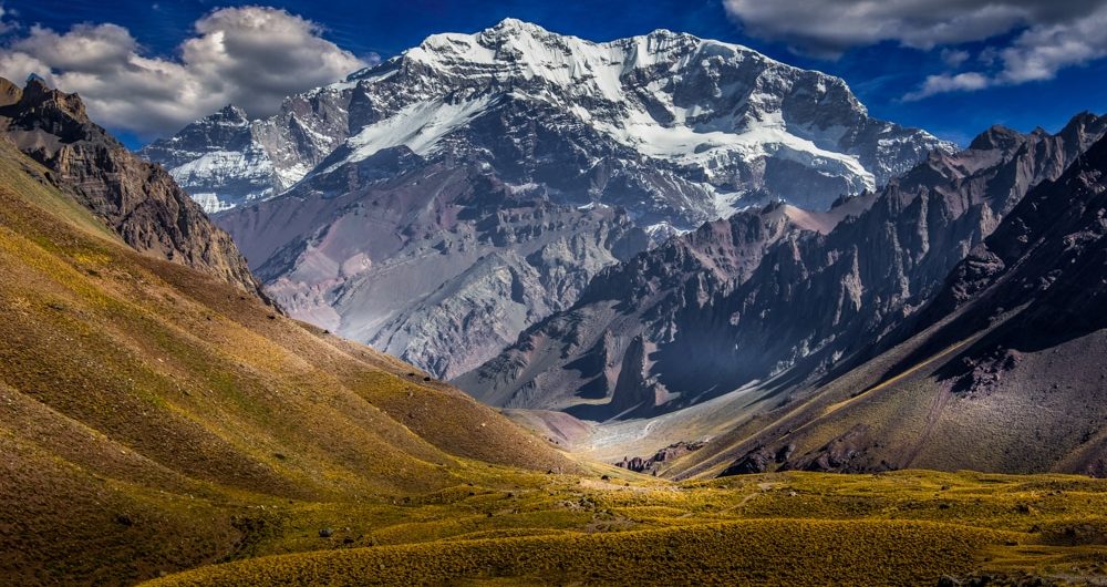
Kilimanjaro is, after all, a hike. It's not quite an expedition, but more like a long weekend trek. It's a pleasant trek because it passes across several distinct plant zones. Guiding is required. You generally have porters as well, so trekking with just a little day bag and a few hours a day is really comfortable. Summit day is just like any other trek, except that you have to start early because of some bizarre obsession with the sunrise - I think they're just trying to make these 6 hours or so seem longer than they are. For the great majority of individuals, altitude is not a concern. For practically any reasonably fit hiker, this is the place to be. It was a wonderful trek. There aren't any technical paths to take. It's a lovely African colossus. Check out Mount Kilimanjaro packages Which one is higher, Aconcagua or Kilimanjaro? Aconcagua measuring 6,961 meters above sea level is far higher the Mount Kilimanjaro at 5.895 meters and is not located on the equator. While the primary route is still mostly a trek, it is not intended to be a long weekend excursion. You're on a considerably more adventurous mission here, with the weather playing a major influence (not really a factor on Kilimanjaro). I spent the greatest amount of time on a permit (3 weeks vs. 5 days). There are both technical and extremely tough paths up. It's a significant difficulty increase from Kilimanjaro. Kilimanjaro has a low mortality rate compared to the number of summits; on Aconcagua. Kilimanjaro does not have many expert climbers dying. The guides' risk-taking abilities are also unrivaled: Climbing Aconcagua is more dangerous than Kilimanjaro Because of the dangers, guides in Aconcagua are exceedingly cautious and always stick to the plan. Daily medical tests are conducted
Kilimanjaro is, after all, a hike. It’s not quite an expedition, but more like a long weekend trek. It’s a pleasant trek because it passes across several distinct plant zones. Guiding is required. You generally have porters as well, so trekking with just a little day bag and a few hours a day is really