The cost to enter Mount Kenya park is always changing according to the Kenya Wildlife Service (to the extent that most websites offering Mount Kenya treks are displaying out-of-date prices). Currently, adult admission fees range from $150 for a three-day package to $220 for four days or $300 for five days. This includes both the admission price and camping costs. Therefore, 4 days in the park cost $220 per person on a usual 5-day Sirimon Naro-Moru itinerary through Nairobi. For current prices, visit http://www.kws.org. Kenya Wildlife Service Fees for Mount Kenya The Kenya Wildlife Service, which oversees and manages protected areas in Kenya, including the majority of national parks, is in charge of Mountain Kenya National Park. Kenya Wildlife Services is in charge of collecting the park entrance fees. There are entrance fees for the Mountain Kenya National Park for visitors, groups, safari guides, vehicles, and airplanes. Additionally, charges are made based on the tourist's status, such as whether they are a citizen, resident, or international non-resident. Related, these are the Mount Kilimanjaro National Park fees and regulations The following are the Mountain Kenya National Park fees: Park fees for entering Mount Kenya Anyone accessing Mount Kenya must pay park fees and these are the fees required to enter Mount Kenya National Park Read how much it costs to climb Mount Kenya here. Status Age Fees East African Citizens (KSHS) Children/ students 300 Adults 215 Foreign residents (KSHS) Children 1,030 Adults 515 Non-foreign residents (US$) Children/students 43 Adult 26 Activity fees Any activity a visitor takes part in while visiting the mountain Kenya national park is subject to an activity fee. Main activities Activity Citizens Residents Non-residents Adult (KSH) Children/ Students (KSHS) Adult (KSH) Children/ students (KSH) Adult (US$) Children/ students (US$) Mountain climbing Day trip 430 215 775
The cost to enter Mount Kenya park is always changing according to the Kenya Wildlife Service (to the extent that most websites offering Mount Kenya treks are displaying out-of-date prices). Currently, adult admission fees range from $150 for a three-day package to $220 for four days or $300 for five days. This includes both the
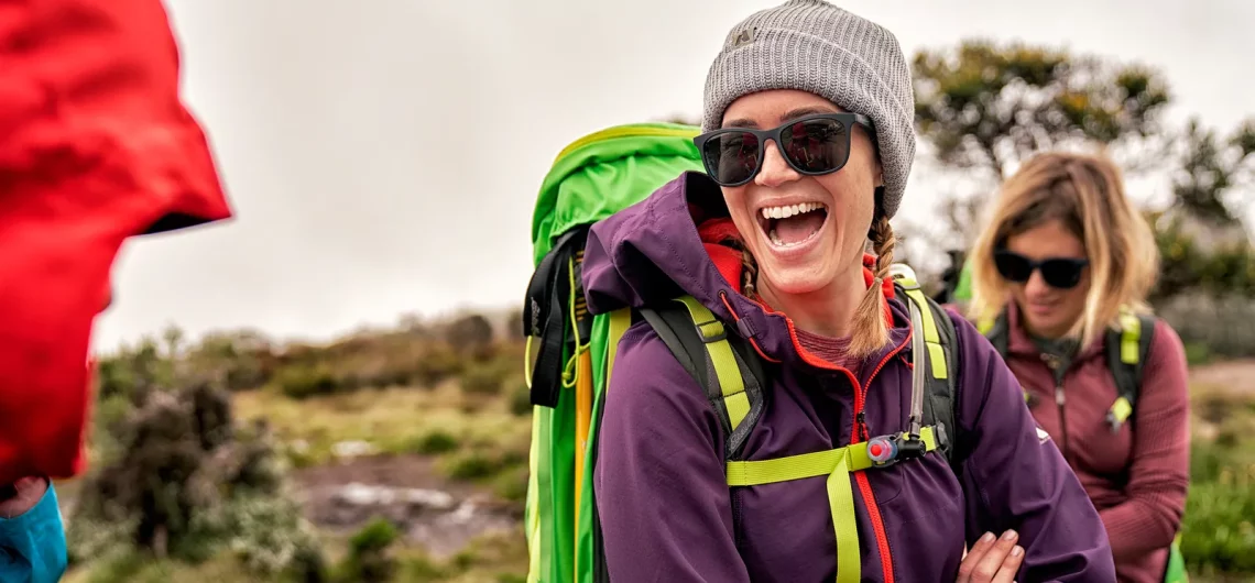
Sunglasses for climbing Kilimanjaro are often overlooked when packing your gear for your trek in Tanzania but in one way or the other, they play an important role. to protect your precious eyes against snow blindness. For this sole reason and many others, the earliest types of eye protection were developed. To shield their eyes from the sun's glare off the snow, early northerners constructed a variety of goggles out of wood or bone. Thankfully, modern eyeglasses offer better eye protection than a piece of wood. They are an essential component of hiking and climbing gear. Reasons why you should wear sunglasses on Mount Kilimanjaro Sunglasses' main function, as its name suggests, is to shield your eyes from the sun. At higher elevations, where ultraviolet (UV) light from the sun's beams is more potent than at sea level, this is especially crucial. The sun's intense brightness may short-term induce eye strain and weariness and below is why you should consider wearing sunglasses on your trek to Uhuru Peak, summit. ALTITUDE: Every 3,300 feet/1,000 meters of elevation gain causes the UV radiation at altitude to increase by 10–12%. Therefore, the sun is 60–72% more powerful at Uhuru Peak than it is at sea level. LATITUDE: The levels of UV radiation increase with distance from the equator. 3.03 degrees are south of the equator on Kilimanjaro. GROUND REFLECTION: Snow is a reflector of UV rays. As a result, trekking on snow, which is commonly above 15,000 feet/4,572 meters, can reflect up to 80% of UV light. But on the mountain, your requirements won't be met by the fashionable sunglasses you wear while driving or walking down the street. So what qualities should you seek for in sunglasses before your hike? Let's think of the lenses and frames as separate components of sunglasses.
Sunglasses for climbing Kilimanjaro are often overlooked when packing your gear for your trek in Tanzania but in one way or the other, they play an important role. to protect your precious eyes against snow blindness. For this sole reason and many others, the earliest types of eye protection were developed. To shield their eyes
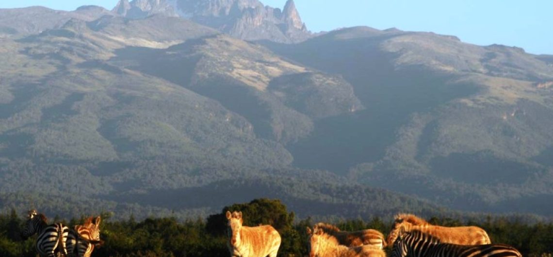
The cost or price of climbing Mount Kenya is affected by a variety of variables, including the number of climbers in your group and the days required to climb which is also determined by the route you choose, including park fees and facilitation costs. The travel agency you select and the time of year you ascend the mountain are further considerations. On Mount Kenya, there are many hiking routes, which means there are various alternatives and costs. The price of ascending the mountain need to include park and administrative costs. Typically, a good price is $200 per day, per person. There are many alternatives and costs because there are several designated trekking trails on Mount Kenya. Mt. Kenya may be climbed in as short as 4 days, although it can also be traversed over 6 days. No matter which path you take, spending 4 to 5 days on the mountain might cost between 600 and 700 EUR or 700 and 800 USD. For instance, you should budget around 975 EUR or 1080 USD if you want to do the Burguret - Chogoria Traverse. What determines the price of climbing Mount Kenya? It should be an enjoyable and affordable adventure to hike Mount Kenya. For those who seek this experience, tranquil Kilimanjaro provides packages ranging from inexpensive hikes to opulent treks. Prior to making travel arrangements to Mount Kenya, it's crucial to pick a package you can afford. Here are a few elements that affect how much it will cost to climb Mount Kenya. They consist of; Read also: How much it costs to climb Mount Kilimanjaro Days Spent on the Mountain The price of climbing Mount Kenya might vary depending on how many days you want to stay there. The cost will be less if you schedule fewer days than
The cost or price of climbing Mount Kenya is affected by a variety of variables, including the number of climbers in your group and the days required to climb which is also determined by the route you choose, including park fees and facilitation costs. The travel agency you select and the time of year you
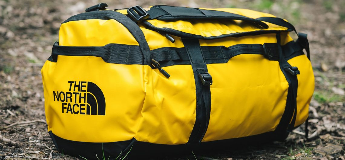
The capacity of the duffel bag is the main consideration. Make sure you have enough room inside for all of your equipment. Included in this is the sleeping bag, which often consumes the most room. We recommend a duffel bag with a capacity of 70 to 90 liters. You will need a daypack (or backpack) and a duffel bag to climb Mount Kilimanjaro. During the treks between camps, climbers are responsible for just packing what they might require. Sleeping bags, toiletries, and additional clothes should all be kept inside a duffel bag that our porters will transport from one campsite to the other. As you walk between campgrounds, you'll have a day pack to carry your necessities. Your daypack should have items like extra layers of clothes, sunglasses, a camera, food, and a drink or two. You will require a duffel bag for the remainder of your equipment. You'll prepare your duffel bag each morning. The next campsite will be reached by the porters carrying it. Although there is a large variety here, it all relies on the equipment that each customer provides. Check out the top 4 best duffel bags for Kilimanjaro treks Some seasoned minimalist travelers can fit everything into a 50-liter bag with ease, whereas others find it difficult to do so even with a 90-liter bag. Although we believe that a 70-liter duffel should fit almost everyone, err on the side of buying a larger duffel bag if you are heading to the store to buy one. Just keep in mind that although there is no restriction on how much our porters may carry in terms of volume, there is a rigorous weight limit of 15 kilos or around 33 pounds. A 70-90 liter duffel bag is the best option if you have a porter to
The capacity of the duffel bag is the main consideration. Make sure you have enough room inside for all of your equipment. Included in this is the sleeping bag, which often consumes the most room. We recommend a duffel bag with a capacity of 70 to 90 liters. You will need a daypack (or backpack)
The top 4 best duffel bag brands for climbing Kilimanjaro from reliable manufacturers are listed in this informative article. One of the most essential items to have on your kit list is a duffel bag. Your sleeping bag, clothing, rain gear, sleeping mats, food, etc. are all carried in a duffel bag. Therefore, it's crucial to invest in a sturdy duffel bag that can accommodate all of your necessities and is easy to carry when climbing Mount Kilimanjaro. Authorities in Kilimanjaro National Park have allowed the duffel bag to weigh no more than 15 Kg (33 lbs.). See the recommended duffel bag size and capacity for Kilimanjaro The Best duffel bags for trekking Kilimanjaro For carrying your main gear on the mountain, we recommend using a 110-120L duffle bag. Here are my recommendations for strong, premium backpacks that you may use for your journey up Mount Kilimanjaro and other hiking adventures like Mount Meru or Mount Kenya, Ruwenzori Mountains, Mount Meru or the Ol Doinyo Lengai: 1. Patagonia Black Hole The fabric of this duffel is incredibly strong and weather-resistant because it is produced entirely from recycled materials. There are three options for sizes and colors: 55L, 70L, and 100L. Each one has removable shoulder straps. The main compartment has a wide D-zip opening and complete access. Additionally, there is an inside, secure pocket and a smaller side pocket that are both accessible from the outside (good for keys, medications, etc.). Check out the prices for this Patagonia Black Hole duffel bag here 2. Mountain Hardwear Camp 4 Mountain Hardwear's 95-liter duffel is tough and water-resistant. While the external zipped bag may contain soiled gear and shoes, the inside mesh zipper pockets let you organize your smaller items and toiletries. You can carry your bag with ease thanks to the
The top 4 best duffel bag brands for climbing Kilimanjaro from reliable manufacturers are listed in this informative article. One of the most essential items to have on your kit list is a duffel bag. Your sleeping bag, clothing, rain gear, sleeping mats, food, etc. are all carried in a duffel bag. Therefore, it’s crucial