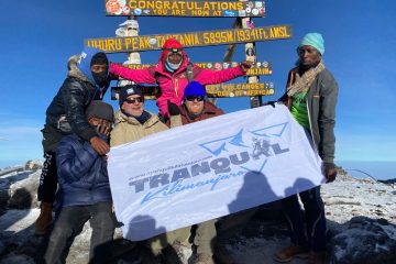
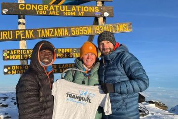
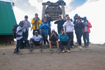
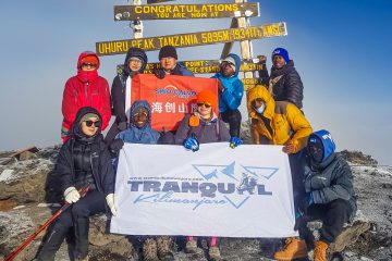
Mbege, a local brew popular in the Kilimanjaro region is commonly known as banana beer among the Chagga people that live around Kilimanjaro but tastes more like wine. This local alcoholic beverage is traditionally solely brewed by females and it requires a lot of labor and takes a long time. The Chagga people are from the slopes at the foot of Africa's tallest peak, Mount Kilimanjaro. Mbege is a distinctive tradition practiced by the Chagga people. Ripe bananas and millet powder that has been sprouted are used to make the alcoholic beverage Mbege. To produce Mbege not just any kind of bananas can be used but only a specific kind of bananas from the farm are gathered. The term "ndizi ngombe," which translates to "cow bananas," is used to describe a particular variety of bananas that is used in preparing this important brew that often brings people together. After being picked, bananas are kept in a warm, dark location to ripen. Depending on the weather, bananas might take up to seven days to attain an appropriate level of maturity. Related: Best Tanzanian beers to drink and refresh after climbing Kilimanjaro Bananas are cooked in a large saucepan of water after the skins are removed once they are fully ripe. The bananas are originally yellowish-white, but after simmering for about 6 hours, they take on a reddish-brown hue that signifies completion. After that, the banana mixture is placed in a jar and let to ferment for a few days. The finger millet is made while it ferments. In order for the millet to germinate, it is often wrapped in plastic. After being sprouted, the millet is dried in the sun before being ground into flour. The banana mixture is prepared when white bubbles start to emerge on its surface. The males
Mbege, a local brew popular in the Kilimanjaro region is commonly known as banana beer among the Chagga people that live around Kilimanjaro but tastes more like wine. This local alcoholic beverage is traditionally solely brewed by females and it requires a lot of labor and takes a long time. The Chagga people are from
Mount Meru is situated within Arusha National Park, 70 kilometers (43 miles) west of Mount Kilimanjaro in Tanzania. A hike to the peak of Mount Meru can be done in three days instead of the usual four days required for the climb. Mount Meru, a dormant stratovolcano with a height of 4,566 meters (14,980 feet), is the fifth-highest peak in Africa and can be seen on a clear day from Mount Kilimanjaro. As you trek through wild animals, Mount Meru, Tanzania's second-highest mountain, offers a spectacular wildlife experience with no traffic. In this article, we are going to locate Mount Meru in Tanzania, not to be confused with Mount Meru (Sumeru, Sineru, or Mahmeru) in India, which is a holy mountain in Hindu, Jain, and Buddhist cosmologies. Read: Where is Mount Kilimanjaro? Where in the world is Mount Meru? Location: North of Arusha City, in the Arusha Region of Tanzania. Province: Arusha Country: Tanzania Geographical Region: East Africa Tanzania, an East African nation bordered by Kenya to the north and the Indian Ocean to the west, is where Mount Meru is situated. Tanzania is one of the countries found on the African continent. The African continent's tallest peak, Mount Kilimanjaro, is located 322 kilometers (200 miles) south of the equator. Mount Meru is situated 85 km kilometers from Moshi, 51 kilometers from Arusha, 277 kilometers from Nairobi, Kenya, and 631 kilometers from Dar es Salaam, Tanzania. Click here to book a Mount Meru trek Where on the map is Mount Meru? Mount Kilimanjaro's latitude and longitude on a map are respectively 3°14′48″S and 36°44′54″E. On a map, Tanzania, which is in East Africa, is where the peak is situated. Tanzania borders Kenya, Malawi, and the Indian Ocean on the globe map. The second highest peak in Tanzania Standing at
Mount Meru is situated within Arusha National Park, 70 kilometers (43 miles) west of Mount Kilimanjaro in Tanzania. A hike to the peak of Mount Meru can be done in three days instead of the usual four days required for the climb. Mount Meru, a dormant stratovolcano with a height of 4,566 meters (14,980 feet),
Mount Meru is Tanzania's second-highest peak and Kilimanjaro's little brother. Its tremendous 4,566 meters (14,968 ft) elevation makes it stand about 70 kilometers (or 43 miles) to the west of Kilimanjaro. On a clear day, you might be able to view its top from some locations on Kilimanjaro. Mount Meru was formerly an erupting volcano like Kilimanjaro. Kilimanjaro is regarded as an extinct volcano, which means it will never erupt again. Mount Meru, on the other hand, did erupt about 100 years ago, making it legally a dormant volcano. It takes a maximum of 4 days to climb Mount Meru typically requires 3–4 days to climb. This is a fantastic workout to help you adjust to the Kilimanjaro experience, and it's also a fantastic adventure in and of itself. Abundant Wildlife viewing Climbing Mount Meru entails a walking safari through Arusha National Park, where sights of buffalo, bushbucks, zebra herds, and maybe giraffes are guaranteed. The woods of Mount Meru are home to a wide variety of birds, primates, and alpine species, providing visitors with an up-close wildlife encounter that is only possible in Arusha National Park. Adventure seekers will enjoy the thrilling trekking experience around the crater rim on the last ascent to Mount Meru's summit. It has only one route On Mount Meru, the Momella Route is the sole designated route. The climb up Mount Meru, which is often disregarded by tourists, is an amazing adventure. Each trekking group is accompanied by an armed ranger from the Arusha National Park service since there is a good probability they will spot animals along the way. Mount Meru, Kilimanjaro's little brother An active stratovolcano, Mount Meru (4,566 m) is the centerpiece of Tanzania's Arusha National Park. The peak is frequently referred to as the "little brother" of Mount Kilimanjaro. The
Mount Meru is Tanzania’s second-highest peak and Kilimanjaro’s little brother. Its tremendous 4,566 meters (14,968 ft) elevation makes it stand about 70 kilometers (or 43 miles) to the west of Kilimanjaro. On a clear day, you might be able to view its top from some locations on Kilimanjaro. Mount Meru was formerly an erupting volcano
No, Mount Kilimanjaro at 5,895m is not the tallest mountain in the world, the title goes to Mount Everest, also known as Jomolungma, in the Himalayas which is the tallest peak in the world. One of the world's most difficult mountains to climb, its top rises to an astounding 8,849 meters (29,031 feet) above sea level. But this still depends on how you look at it because Kilimanjaro is not only the tallest mountain in Africa but also the highest free-standing mountain in the world since the other mountains higher than Kilimanjaro belong to mountain ranges. Sometimes people consider climbing Kilimanjaro as one of the first training ascents for climbing Everest. In actuality, the Everest base camps, which are located at 5,364 meters in the south and 5,150 meters in the north, are not far from the peak of Kilimanjaro. Mount Kilimanjaro may be viewed as virtually a leisure sport in comparison to Everest climbing excursions, which can take up to two months to finish and need substantial preparation. Kilimanjaro has also been acknowledged as the world's tallest free-standing mountain. Everest is a member of the Himalayan mountain range, as was previously said, and it is bordered by several other eight-thousanders (peaks over 8,000 meters). Kilimanjaro is an isolated mountain that towers magnificently over the unpolluted African grassland. The highest mountain in Africa and the world's tallest free-standing summit is Kilimanjaro. It is a volcano that has erupted and then died. Climbers can virtually be on the equator here and yet experience ice and snow. The opportunity to climb one of the Seven Summits and see Africa's biodiversity is provided by the Kilimanjaro hike. If you're lucky, you could even see some unusual creatures. Related: How high is Mount Kilimanjaro? The highest Mountain in Africa and World's tallest free-standing mountain
No, Mount Kilimanjaro at 5,895m is not the tallest mountain in the world, the title goes to Mount Everest, also known as Jomolungma, in the Himalayas which is the tallest peak in the world. One of the world’s most difficult mountains to climb, its top rises to an astounding 8,849 meters (29,031 feet) above sea
Floods in Pakistan, droughts in China, and changes on Mount Everest are all consequences of melting snow and ice in the famous mountain range. Teams of Indian scientists traverse the Himalayan highlands every year when the weather warms up to examine the Chhota Shigri glacier in the country's northern province of Himachal Pradesh. The amount of snow cover has been measured for the previous 15 years, together with soil and air temperatures, surface ice forms, and the seasonal snowmelt discharge that feeds the river valleys below. A glaciologist at the Indian Institute of Technology in Indore, Mohd Farooq Azam, claimed, "We had put it in June and by August we couldn't even detect the vestiges. "Temperatures in March and April topped 100-year records, and we had an extreme heat wave in the early summer. And as a result, the glaciers melted. Last week, while our crew was on a glacier, we witnessed record-breaking melting in the Himalayas. The world's unprecedented heat waves this summer are melting snow and ice, not just in Europe's Alps but also in the famed Himalayan range, which is home to the world's largest frozen freshwater reserve outside of the North and South poles. A fragile system that has helped manage the earth's climate and important water cycles for millennia is becoming unstable as a result of global warming, which is hastening the melting of Himalayan glaciers far more quickly than scientists had previously predicted. In Pakistan, where floods have swamped towns and agriculture, impacting more than 30 million people and killing up to 1,000 people since June, the effect is particularly severe. There, the intense monsoon rains brought on by the rising Arabian Sea and the weather-changing impacts of La Nina have combined with glacier melt to create what Pakistani officials have dubbed a "climate
Floods in Pakistan, droughts in China, and changes on Mount Everest are all consequences of melting snow and ice in the famous mountain range. Teams of Indian scientists traverse the Himalayan highlands every year when the weather warms up to examine the Chhota Shigri glacier in the country’s northern province of Himachal Pradesh. The amount