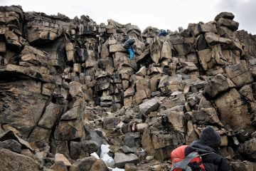
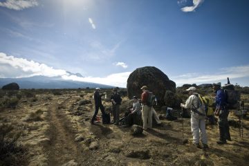
Location of Uluguru Mountains
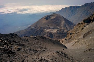
These mountain ranges of the Uluguru are situated approximately 190 kilometers west of Dar es Salaam City. You may get there by car, rail, or plane. The peak overlooks the agricultural region surrounding Morogoro, and in some ways, Morogoro town is located at the base of Uluguru Mountain.
The Uluguru Mountain is located between the rural and Mvomero districts of Morogoro. Waluguru is the name of the native tribe that lives in the area. It’s a component of the Arc of the Eastern Mountains. The streams from this mountain enter the Ruvu River, which supplies Dar es Salaam with water. The highest point is 2,630 feet above sea level. Uluguru Mountain is encircled by 51 communities, with a total population of almost 151, 000 people. Uluguru South, Kasanga Mkangala, Mlaliwala, Ngababaula, Tongeni River, and others are among the reserves.
These reserves encompass a total of 37,700 hectares.
Vegetation
The Uluguru main ridge and surrounding sections have a wide range of plants. It includes drier lowland coastal forest habitats, transitional rainforests, sub-montane, montane, and higher montane forest types, as well as sub-montane, montane, and upper montane forest types.
Climate
The Uluguru mountains collect moisture that comes inland from the Indian Ocean, making the east-facing slopes very wet, with annual rainfall estimated to be above 3,000 millimeters (120 in) with rain falling every month.
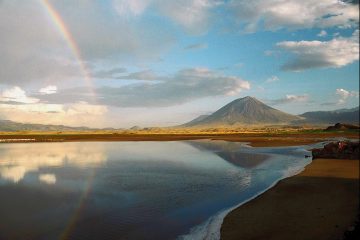
The Uluguru Mountains may be seen in the background of Morogoro.
The Luguru Tribe
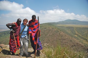
The Waluguru tribe is the native population of the Ulugurus. They have lived in the mountains for hundreds of years, having migrated from other parts of Tanzania.
In contrast to other tribes in Tanzania, where males control the land and make the majority of decisions concerning its use and administration, their land is passed down via the female line, and women are powerful in village life.
“Luguru” is a local term that means “people of the highlands.” Waluguru are mountain people who, according to legend, once fought the zigua. Luguru shifted from lower ground to mountains when Zigua vanquished him. Cultivation is their primary activity. Bananas, yams, cassava, and millet are among the crops they cultivate. Although, in recent years, people have begun to own animals.
The Uluguru Forests, a water catchment area
The mountains’ forests serve as water catchment regions for streams and rivers.
This water mostly comes from the Ulugurus’ forest-covered summits into tributaries that converge to form the Ruvu River, which supplies water to Dar es Salaam. The majority of the surrounding population, around 3 million people, as well as Tanzania’s key businesses, rely on this water supply to survive. [4] The loss of the Uluguru forests, as well as any diminution in the mountains’ water supply potential, might have a significant impact on Tanzania’s human well-being and industrial capabilities.
The area of forest on the Ulugurus has been quantified over time. In 1955 there was over 300 sq. km of forest remaining. By 1977 this had been reduced to 260 sq. km, and currently the forest area is around 200 sq. km. The majority of the loss of forest has been at lower altitudes and outside of the Forest Reserves which are providing a valuable refuge for forests on the mountain.
Over 100 plants, birds, mammals, reptiles, and amphibians are only found in the Ulugurus.
A huge number of other species are only found in one or two other Eastern Arc mountains, making them globally uncommon. African violets, Impatiens, and Begonias are endemic species that are popular pot plants in other parts of the world.
Some of the species of the Ulugurus are known to favour the lower altitude forest (700-1500 m) which has been most heavily lost during the past 45 years. This includes the endemic Uluguru Bush Shrike. Its population must have declined over the past decades.
The Ulugurus contain a wide altitudinal range of forest, with exceptional biological importance throughout this range. Above 700 m there are areas of sub-montane and higher montane and upper montane forests. On the eastern lowland (200-300m) margins of the Ulugurus are also found lowland forest blocks, which are more closely related to a chain of small forest patches found along the coast of eastern Africa. Hence the Ulugurus contain examples of two of the main forest types in Eastern Africa (montane and lowland coastal).
The montane forests of the Uluguru Mountains are a part of the Tanzania-Malawi Mountains Endemic Bird Area defined by BirdLife International . This chain of mountains is of great conservation importance. The forests of the Uluguru Mountains portion of this Endemic Bird Area are one of the most important parts of this larger area. The Uluguru mountains forests support three endemic bird species (Uluguru Bush Shrike Malaconotus alius, Loveridge’s Sunbird Nectarinia loveridgei and further taxonomic work will probably recognise a new species in the Mountain Greenbul complex – Andropadus neumanii). They also hold important populations of a number of other bird species that are only found in the Eastern Arc Mountains.
In addition to the birds the Ulugurus support many other plants and animals which are either wholly endemic to the mountain, or are shared with other Eastern Arc mountain forests. In summary there are believed to be 15 species of vertebrate animal and more than 150 species of invertebrate animal only found on the Ulugurus, together with perhaps 100 endemic plant species (see attached downloadable file). The plants include endemic or near-endemic examples of several well-known house plants in temperate countries: Saintpaulia (African Violet), Impatiens (Busy Lizzie), Begonia and Streptocarpus. Many of these are only found in the Ulugurus, particularly in the montane forests.
The lowland forests on the eastern margins of the Ulugurus are an outlier of the Tanzania-Kenya coastal lowland forests EBA. They support some of the characteristic species of plants and amphibians of the coastal forests (in particular 13 endemic plant species in Kimboza forest), but they do not contain the coastal forest endemic birds.
Species of birds, mammals, reptiles and amphibians endemic to the Uluguru Mountains and notes on their altitudinal distribution and most recent records
| Species | Described | Alt Distribution | Most recent records, plus notes on abundance |
| | | |
| BIRDS |
| | | |
| Malaconotus alius | Friedmann, 1927 | 1320-1710 m | 2000, pop c.1,150 pairs |
| Nectarinia loveridgei | Hartert, 1922 | | 1200-2580 m 2000, pop 10,000 plus pairs |
| | | |
| MAMMALS |
| | | |
| Crocidura telfordi | Hutterer, 1986 | | 1990s collected by W. Stanley |
| Myosorex geata | Allen & Loveridge, 1927 | | 1990s collected by W. Stanley |
| | | |
| REPTILES |
| | | |
| Prosymna ornatissima | Barbour & Loveridge, 1928 | 700-1000 m | Last collected 1926, Mt. Tongoni (Uluguru North) |
| Rhampholeon uluguruensis | Tilbury & Emmrich, 1996 | | Collected 2000 |
| Typhlops uluguruensis | Barbour & Loveridge, 1928 | 750m | Last collected 1926, Bagilo |
| | | |
| AMPHIBIANS |
| | | |
| Nectophrynoides cryptus | Perret, 1971 | 1500 m plus? | Collected 2000, U. South. |
| Nectophrynoides minutus | Perret, 1972 | 1500 m plus? | Collected 2000, U. South |
| Probreviceps uluguruensis | Loveridge, 1925 | 1500 m plus | Collected 2000, U. South |
| Scolecomorphus uluguruensis | Barbour & Loveridge, 1928 | 1500 m plus | Collected 2000, U. North |
| Hyperolius tornieri | Ahl, 1931 | 1500 m plus | Taxonomically problematic |
Hiking the Uluguru Mountains
The mountains draw a large number of tourists to the area, owing to its closeness to Dar es Salaam, Tanzania’s former capital and economic center.
From Morogoro town, Uluguru Mountain trekking takes only one day (up and down).
What to wear for an Uluguru Mountain Hike
Waterproof footwear is essential for the trip because the path is usually flooded or muddy for the majority of the time.
The weather is pleasant, therefore there is no need for chilly cloth….a single coat would be enough.


